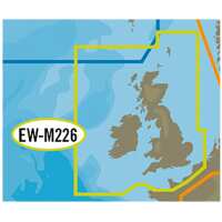
C-Map MAX Wide - UK, Ireland & The Channel - The MAX format charts gracefully combine unparalleled levels of chart accuracy & detail, striking presentation & a huge collection of new value-added data. MAX gives compatible chart plotters lightning fast, knockout performance plus real-life accuracy & detail. See NavAids on-screen exactly as they appear. Get at-a-glimpse" information about current strength & direction Even view an aerial photograph of an unfamiliar inlet before you enter. Features:- • Dynamic NavAids • Guardian Alarm • Route-check • Detailed Harbour Charts • C-Marina Port Database • Multi-Language capability • Dynamic Tide and currents • Photos and Diagrams • Depths and land elevation • Perspective view • Points of interest and road mapping. Supplied on Micro SD Card with Full SD adapter - Please specify the make & model of your plotter when ordering so we can supply the correct format. PLEASE NOTE: Due to Programming - Electronic Charts are not available on Next Day Shipping Services
Visit Product Page