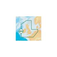
28XG - UK, Ireland & Holland Navionics plus charts offer seamless, paper-like chart detail at up to 16 zoom levels. Features include shaded depth contours, coloured nav light sectors, real-world shapes & colours of buoys, spot soundings, tide & current data, database of wrecks, detailed port plans and port service guides. Daily Updates Navionics charts are updated with around 2,000 edits per day. See how simple it is to download the very latest content and free daily updates for 1 year You’ll get official chart information supplemented with contributions from fellow boaters in SonarChart and Community Edits. 1 ft/0.5 m HD bathymetry Enjoy the exclusive SonarChart™ layer with up to 1 ft/0.5 m contours. Upload your sonar logs to build even better local charts for your area. You can do it with your plotter or use your mobile device connected wirelessly to your sounder with SonarChart™ Live. Detailed charts and more Nautical Chart is a robust chart resource trusted by boaters worldwide. SonarChart™ is an HD bathymetry map that reflects ever-changing conditions. Community Edits are localized chart data contributed by the Navionics Community. Plotter Sync If you own select B&G, Lowrance, Simrad and Raymarine Wi-Fi plotters, you can activate your Navionics+ card, transfer routes and markers, and upload sonar logs right from your boat! Download new coverage areas and updates to your card wirelessly by connecting an iPhone, iPad or Android with the Navionics Boating app to your plotter. Autorouting Autorouting is available using Navionics charts on compatible plotters from B&G, Lowrance, Simrad and Raymarine in many areas of the world. A convenient, easy-to-use tool. New Dock-to-dock Autorouting, now available with B&G, Lowrance, Simrad and Raymarine compatible plotter offers a unique breakthrough in boating navigation, as it quickly creates detailed routes from a real start point to a real end point, even through narrow passages and channels where they’re needed most, using sophisticated algorithms. Please specify the make & model of your chartplotter when ordering, so we can supply the chart in the correct format.
Visit Product Page